St Nicholas Police Station
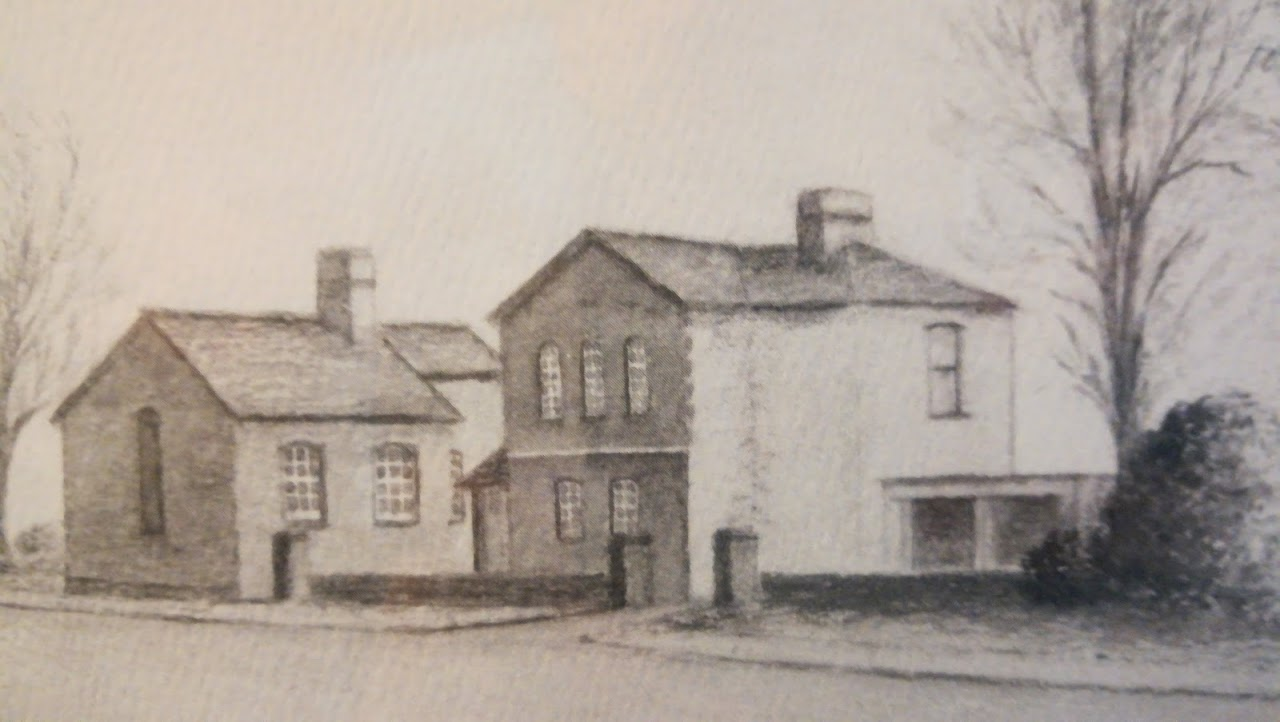
Built in 1858, under the instruction of Captain Charles Frederick Napier, the first Chief Constable of Glamorgan, working with support from the Marquis of Bute, it’s believed to be the first purpose-built police station in the county. Napier was in office from 1841 until 1867 and upon his death the Police Force had risen from 34 men to almost 200.
The building is a landmark within St Nicholas, being very distinctive in design, and making a valuable contribution to the quality and character of the St Nicholas Conservation Area.
Mr Neil Walklate has conducted further research:
POLICE STATION
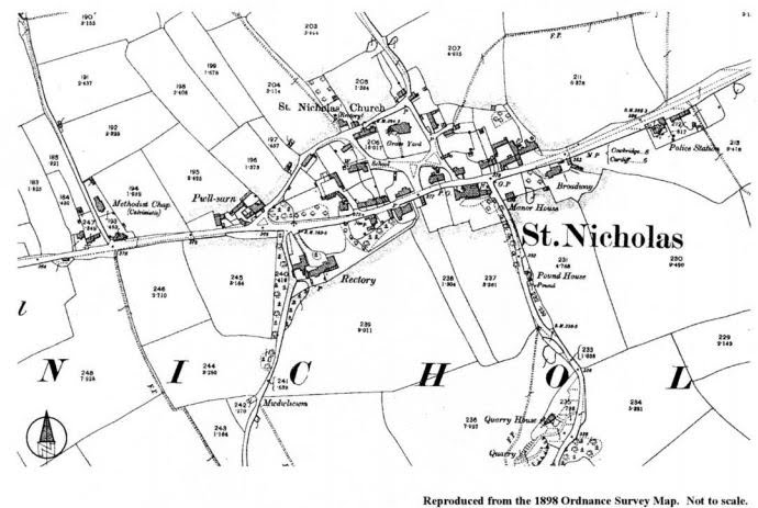
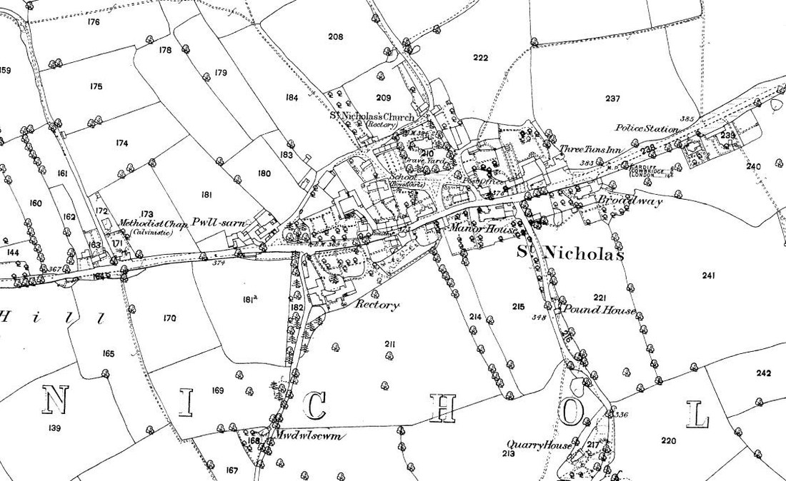
It was in 1841 that the County of Glamorgan first set up a police force and initially constables were stationed in Cowbridge, Llantwit Major and St Nicholas. The choice of the latter may have been due to the convenient location on the main road between Cardiff and Cowbridge. It is thought to be the first purpose-built police station in the county and it once had an adjacent courthouse which was demolished in the 1970’s. Maps suggest that the courthouse was added between 1878 and 1898.
In the Poor Book dating from the 1820s, the Vestry had appointed parish constables at 10s. 1d. a year, but in 1851 and 1854 there are two instances of policemen being sent to the village for a turn of duty. They were Philip Banner with his wife Elizabeth and children and William Jones and family. They lived elsewhere in the village because the Police Station was not built until 1858. After this date, apart from the occasional local parish appointments, the constabulary lived here and included: Robert Harniman in 1859; John John from Little Newcastle, Pembrokeshire in 1861; Thomas Griffiths in 1864; James Rutter from Devon in 1871; Phillip Williams from Pembrokeshire in 1881; Sergeant William Brinson in 1884, whose wife gave birth to twin boys both of whom died within six weeks; Sergeant Walter Chorley in 1888; in 1890 Sergeant William James from Carmarthenshire was in residence with his wife and two sons. Also at the station were Police Constables David Jones and Benjamin James. By 1895 it was John Perkins, who died at the age of 33; in 1901 Police Officers Maurice White and Charles Melhuish; in 1903 Sergeant Charles George Lane and in 1904 William Davies. By 1926 it was Sergeant Thomas Hamilton who was still remembered by village octogenarians the 1990s, for the way he dispensed instant justice to errant teenagers. This could include a clip around the ear for misdemeanours, or even a night in the cells followed by an early morning release for slightly more serious matters.
The building is a landmark within St Nicholas, being very distinctive in design, and making a valuable contribution to the quality and character of the St Nicholas Conservation Area.
Mr Neil Walklate has conducted further research:
POLICE STATION
It was in 1841 that the County of Glamorgan first set up a police force and initially constables were stationed in Cowbridge, Llantwit Major and St Nicholas. The choice of the latter may have been due to the convenient location on the main road between Cardiff and Cowbridge. It is thought to be the first purpose-built police station in the county and it once had an adjacent courthouse which was demolished in the 1970’s. Maps suggest that the courthouse was added between 1878 and 1898.
In the Poor Book dating from the 1820s, the Vestry had appointed parish constables at 10s. 1d. a year, but in 1851 and 1854 there are two instances of policemen being sent to the village for a turn of duty. They were Philip Banner with his wife Elizabeth and children and William Jones and family. They lived elsewhere in the village because the Police Station was not built until 1858. After this date, apart from the occasional local parish appointments, the constabulary lived here and included: Robert Harniman in 1859; John John from Little Newcastle, Pembrokeshire in 1861; Thomas Griffiths in 1864; James Rutter from Devon in 1871; Phillip Williams from Pembrokeshire in 1881; Sergeant William Brinson in 1884, whose wife gave birth to twin boys both of whom died within six weeks; Sergeant Walter Chorley in 1888; in 1890 Sergeant William James from Carmarthenshire was in residence with his wife and two sons. Also at the station were Police Constables David Jones and Benjamin James. By 1895 it was John Perkins, who died at the age of 33; in 1901 Police Officers Maurice White and Charles Melhuish; in 1903 Sergeant Charles George Lane and in 1904 William Davies. By 1926 it was Sergeant Thomas Hamilton who was still remembered by village octogenarians the 1990s, for the way he dispensed instant justice to errant teenagers. This could include a clip around the ear for misdemeanours, or even a night in the cells followed by an early morning release for slightly more serious matters.
Map 1878
The village prospered as a farming community during this time, with the passing trade sustaining a number of inns. The Crown Inn, Prince's Arms, The Travellers Rest, and the Three Tuns were all clustered within the area of the church and manor. None exist now, though The Three Tuns is converted to residential use and the Prince's Arms is Trehill House.
By the 19th century, the village had come to sustain a number of small industries, offering carpenters, millers, saddlers, wheelwrights and masons. A smithy operated from the centre of the settlement and an agricultural implement factory, owned by W. T. Wright, was established on the site today occupied by the Laurels. By the 1870s a purpose-built boys’ and girls’ school had been founded; lessons seem formerly to have been conducted in the adjacent cottage. Further public buildings erected during the 19th century include the police station at the eastern end of the village. This was originally provided with a court room, one of the first to be founded in Glamorgan.
The establishment of the Mission Room and Police Station, and the expansion of the school during this period marked the cultural and social development of the rural community. The Cory family were particularly influential in this respect: closing the Three Tuns and opening the Coffee Tavern on the site of the former Travellers Rest. The building is now known as Westways. The Cory family of Dyffryn owned much of the land in the area in the 19th and early 20th centuries.
Between 1891 and 1893 a prestigious new home based on an earlier building, Dyffryn House, was built near to the village for John Cory, a well known local industrialist and philanthropist – the architect was E. A. Lansdowne of Newport. There had been an Elizabethan house on the site, which lies to the south of St. Nicholas along Duffryn Lane, and this had been successively owned by the Button and Pryce families.
Dyffryn is now principally known for its gardens, laid out for Reginald Cory (John Cory’s son) by Thomas Mawson, the internationally known and prolific garden designer. Work began in 1904 and was completed a year later. After Reginald Cory’s death in 1937 the house was sold to Sir Cenydd Traherne who leased the property to the County Council. It is currently vacant and the gardens are designated grade I on the ICOMOS/Cadw Register of Landscapes, Parks and Gardens of Special Interest in Wales. Reminders of the links between the Cory family and St. Nicholas are still provided by their family tomb in the churchyard, by West House, built as a coffee house on the site of the Travellers’ Rest Inn, and by the church hall and accompanying church hall house on the main road, all of which were promoted by the Cory family.
On the whole, however, the changes brought to the village by the 19th century were relatively few: a comparison between the Tithe Map of 1838 and 1878
The Button family figure a lot in village history, most famously Admiral Thomas Button who discovered Mansel Island in Hudson's Bay, Canada.
The following newspaper story from the 1880's has been taken from the Llancarfan Society newsletter.
Llancarfan Society - Newsletter 104, June 2001
MURDEROUS ATTACK ON A FARMER AT ST NICHOLAS
We regret to report a murderous assault upon Mr D. J. Jenkins, of Llancadle, who, after being seriously maltreated by the miscreants, was plundered. Late on Saturday night the wife of Police-constable Williams, residing at the Police Station, St Nicholas, was aroused by someone calling out from the outside for her husband to come out. On opening the door she saw a trap standing in the roadway, with a man inside who was obviously suffering serious injuries. On her going to the trap she found a young man who, in a very weak voice asked permission to enter, or to be taken somewhere, as he was dying. Her husband was at the time on duty and might not be home for several hours, and as she was alone she hesitated about taking him into her house. She then determined to take him to the Three Tuns, St Nicholas.
On arriving at the inn, the young man, who was very weak from loss of blood, was lifted out of the trap and carried into the bar, where he was recognised as Mr Jenkins, farmer, of Llancadle, and son of Mr Jenkins of Flemingstone-court, both gentlemen occupying very respectable positions and well known through the whole county. ......
While at the Three Tuns, in answer to some questions put by Mrs Banner [landlady], Mr Jenkins was only able to answer that he had been attacked by some persons on the top of the hill near St Nicholas, called "Tumble Down Dick" and that he was beaten with a thick stick and robbed.
Early on Sunday morning a search was made on the road, and above the Traherne Arms, which is half way up the hill, were two pools of blood. -----
Mr Jenkins had attended Cardiff market on Saturday, and was returning home as usual. He had in his possession a gold watch and some £6 or £7 in gold, beside some silver, when he left the Royal Hotel stables at about 11 o'clock. These are all missing.
Mr Jenkins is reported to be a little improved but his sufferings are very great, and when able to bear it, will have to have a surgical operation, as portions of his face are greatly disfigured; indeed permanently injured.
Editorial note. I am indebted to John Cann for this Newspaper extract which, like the one on pages 3 and 4 he found amongst other documents in the David Jones’ (of Wallington) archive.
It is difficult to be sure but the style suggests origin from the same newspaper, possibly the Bridgend Chronicle which carried rather detailed reports from the villages in the Vale.
The cutting probably dates from the 1880's and the young Mr Jenkins of Llancadle is one and the the same as the Mr. D. J. Jenkins, Llancadle, who presided over the ploughing match dinner at the Fox and Hounds Inn as reported on p. 3 & 4. Despite the injuries and the horriffic thought of surgery in those days, he obviously recovered to take up a position of some eminence in Llancarfan parish.
Six or seven pounds in 1880 must have been a very substantial sum of money: farming in the Vale seems to have been a profitable enterprise.
“Tumbledown Dick” was the hill which we now call “The Tumble”, originally a much steeper lane, following a route to the south of the modern road. Tumbledown Dick was also the mocking name given to Richard Cromwell, Oliver’s third son, in enjoyment of his political misfortunes. Does anyone know why his name should have been associated with the hill or was it originally “The Tumble”, picking up the “Dick” at the time of Richard’s notoriety?
Map, Wales - Glamorganshire: 046', Ordnance Survey 1:10,560 - Epoch 1 (1885)
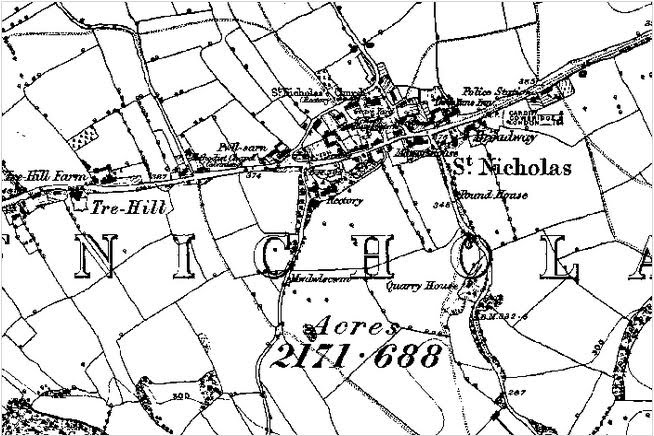
Map, Glamorganshire Boundaries, 1885
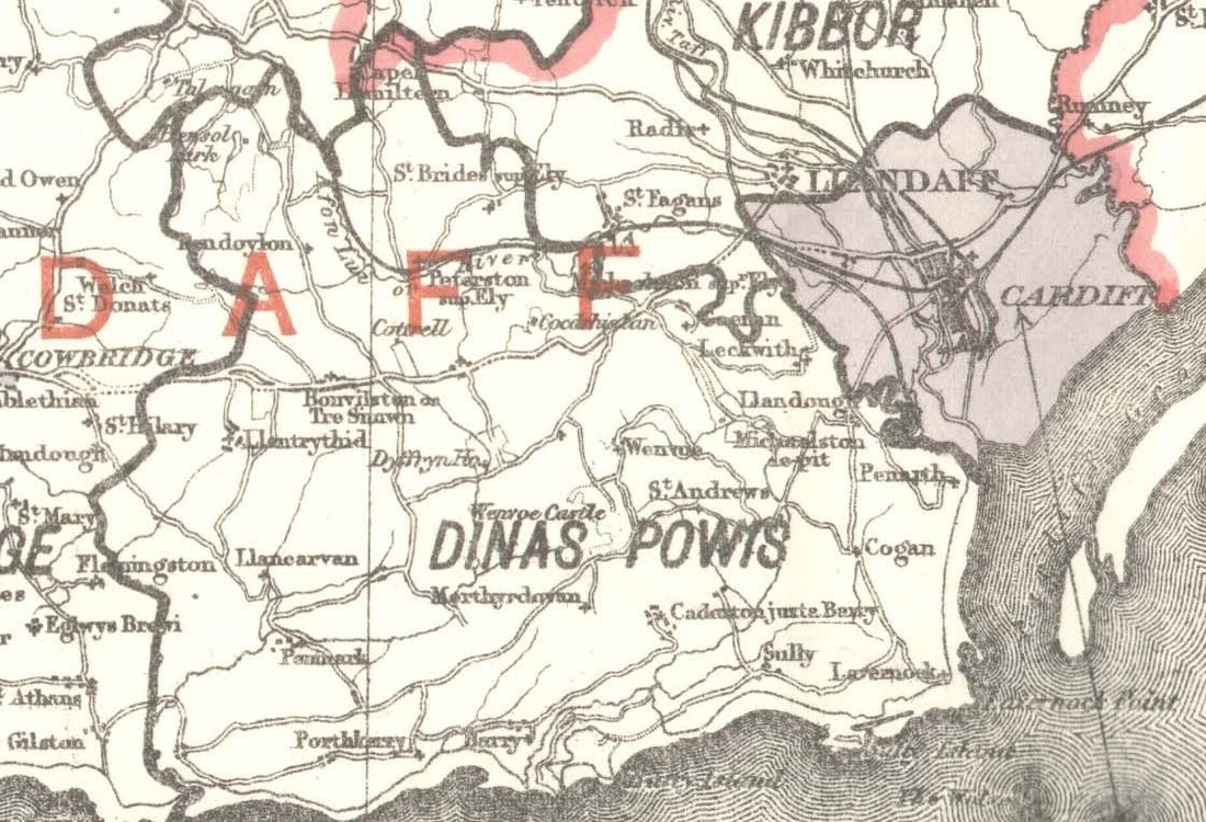
Source: Report of the Boundary Commissioners for England and Wales.
Map, 1898